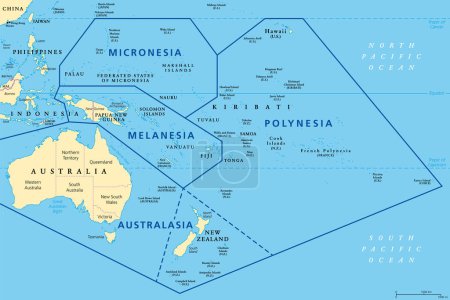
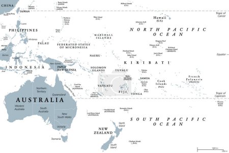
27 Vektoren zum Thema "vanuatu region map" bei ClipDealer

Medien sortieren nach     Gehe zu Seite:    
« Vorherige  1  Nächste »
Vanuatu region map grey outline on white background Detailed map of Vanuatu regions Vector
Subregions of Oceania, political map. Geoscheme with regions in the Pacific Ocean and next to Asia. Melanesia, Micronesia, Polynesia, and Australasia, short for Australia and New Zealand. Vector.
Melanesia, Micronesia and Polynesia, political map. Colored geographic regions of Oceania, southeast of the Asia-Pacific region. English labeling. Illustration on white background. Vector.
Doodle Map of Vanuatu With States
Australia and Oceania Region. Colorful map of countries in South Pacific Ocean. Vector illustration
Regions of Oceania, political map. Colored geographic regions, southeast of the Asia-Pacific region including Australasia, Melanesia, Micronesia and Polynesia. English. Illustration over white. Vector
Oceania, political map. Australia and the Pacific, including New Zealand. Geographic region, southeast of the Asia-Pacific region, including Australasia, Melanesia, Micronesia and Polynesia. Vector.
Oceania, gray political map. Australia and the Pacific, including New Zealand. Geographic region, southeast of the Asia-Pacific region, including Australasia, Melanesia, Micronesia and Polynesia.
Asian, Australia and Oceania countries maps
Australia and Oceania region vector high detailed map with countries names and national flags
Vanuatu map, islands and city with names, white blue card paper 3D vector
Australia and Oceania Region. Map of countries in South Pacific Ocean. Vector illustration
Fifteen Flags of Australia and Oceania countries - alphabetical order with name.  Set of 2d geolocation signs like national flags of Australia and Oceania. Fifteen geolocation signs. EPS10.
Australia and Oceania Region. Map of countries in South Pacific Ocean. Vector illustration
Oceania political map
Melanesia, subregion of Oceania, political map. Extending from New Guinea in southwestern Pacific Ocean to Tonga, including Fiji, Vanuatu, Solomon Islands and Papua New Guinea. Illustration. Vector.
vector maps and flags of oceania countries with administrative divisions (regions borders)
Countries of Oceania and Australia
Vanuatu map
Map and Flag in a circle of 9 Countries: USA, Uzbekistan, Vanuatu, Vatican City, Venezuela, Vietnam, Wales, Yemen, Zambia
Vintage VANUATU Map with Regions Borders and Major Cities Positions
Vanuatu highlighted on a detailed map, geographic location of Vanuatu.
Set of VANUATU Maps with Main Map and Regional maps
Vector large set of flags brush and shadow
Vanuatu outline map set
Set of maps, flag and flagpole of Vanuatu. Vector illustration.
Vanuatu Flag Icons Pack. Vector illustration.

« Vorherige  1  Nächste »