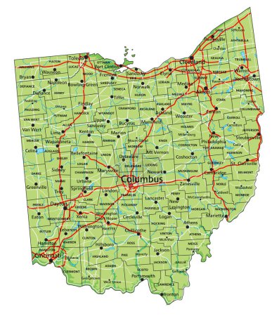
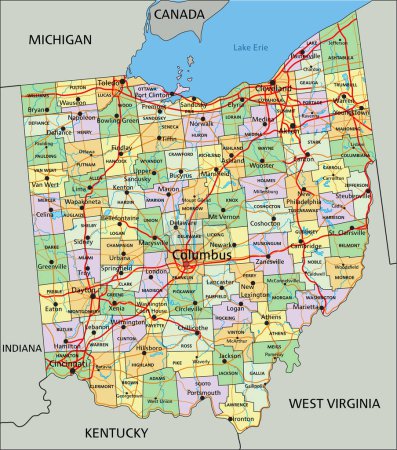
29 Vektoren zum Thema "erie county" bei ClipDealer

Medien sortieren nach     Gehe zu Seite:    
« Vorherige  1  Nächste »
Erie County, Pennsylvania outline map set
Set of generic stamps and signs of Amherst, NY
Erie County (Ohio) blank outline map
Erie County (Pennsylvania) blank outline map
United States, Buffalo, New York, Buffalo City Hall travel landmark line vector illustration
Pennsylvania map
new york administrative map
Pennsylvania state detailed editable map
Ohio state detailed editable map
Map of the Golden Horseshoe metropolitan area around the western end of Lake Ontario, Ontario, Canada
Buffalo, New York. Set of stamps and signs.
Cleveland Ohio grunge rubber stamp
Pennsylvania USA state map vector tag cloud illustration
High detailed Ohio physical map with labeling.
Pennsylvania county map
Highly Detailed Pennsylvania Blind Map.
Pennsylvania administrative and political vector map
Erie County (New York) blank outline map
Pennsylvania, U.S. state, subdivided into 67 counties, multi colored political map with capital Harrisburg, and borders. State of the Mid-Atlantic and Northeastern USA, with nickname Keystone State.
Ohio, OH - detailed political map of US state. Administrative map divided into counties. Blue map with county name labels. Vector illustration
Ohio - Highly detailed editable political map with labeling.
road map of the US American State of New York
New york map
Highly Detailed Ohio Blind Map.
Ohio, OH - detailed political map of US state. Administrative map divided into counties. Thin blank black outline map. Vector illustration
High detailed Ohio road map with labeling.
Pennsylvania County Map
Administrative Map of the Golden Horseshoe metropolitan area, Ontario, Canada
High detailed Ohio physical map.

« Vorherige  1  Nächste »