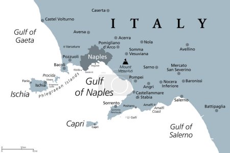
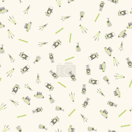
51 Vektoren zum Thema "Field Mapping" bei ClipDealer

Medien sortieren nach     Gehe zu Seite:    
« Vorherige  1  Nächste »
red and grey magnet
GIS for agriculture black line icon. Smart agriculture.
Geodetic equipment vector illustration. Measuring instruments in flat design. Theodolite, tacheometer, total station, drone, level, map sketch isolated on world map background.
Drone or quadcopter for Agriculture. Drone fly over the field and makes spraying or watering. Hands controlling the drone via laptop.
Gulf of Naples, political map. Also Bay of Naples, located along south-western coast of Italy, opening to the Tyrrhenian Sea. Campanian volcanic arc with islands Ischia and Capri and Mount Vesuvius.
Agriculture drone use abstract concept vector illustration. Agriculture precision farming, first responder, analysis, crops spraying, drone surveillance, irrigation monitoring abstract metaphor.
Generic editable vector city map with no names
Agriculture drone use abstract concept vector illustration.
Autumn Harvest Thanksgiving flat mapping pin icon
Tractor field flat mapping pin icon
Gulf of Naples, gray political map. Bay of Naples, located along south-western coast of Italy, opening to the Tyrrhenian Sea. Campanian volcanic arc with islands Ischia and Capri, and Mount Vesuvius.
Farm Field flat mapping pin icon with long shadow
Ears of Wheat, Barley, Rye Field flat mapping pin icon
Geodetic equipment vector illustration. Measuring instruments in flat design. Theodolite, tacheometer, total station, drone, level, map sketch isolated on world map blue background.
Ears of Wheat, Barley Field flat mapping pin icon
Using navigator with modern maps and applications in the car
Agricultural drones isolated cartoon vector illustrations set. Aerial imagery drones, spraying and seed-planting automation in smart farming industry, precision agriculture vector cartoon.
Ears Wheat, Barley Rye on Field flat pin map icon
Mapping pins icons Farm part 2
Geodetic measuring equipment, engineering technology for land survey
Set vector pixel perfect high quality lines icons
Ears of Wheat, Barley or Rye on Field flat mapping pin icon
Geodetic measuring equipment, engineering technology for land survey pattern
Ears Wheat, Barley Rye on Field flat pin map icon
Farm Field flat mapping pin icon with long shadow
Combine harvester flat mapping pin icon with long shadow
City map with road and different locations
Geodetics engineering technology and equipment. Vector line art illustration on city map background
Mapping pins icons Farm part 2
Automated Watering. Drone Irrigation. Isometric
Barn house flat mapping pin icon with long shadow
Isometric stadium buildings set
Geodetic measuring equipment, drone, engineering technology for land survey and geodesy banner
Abstract background with topographic landscape map and pixelated structure
Geodetic measuring equipment, engineering technology for land survey banner on dark background.Isolate icon of theodolit
Scarecrow flat mapping pin icon with long shadow
Seamlesly repeatable diagonal, oblique, slanting lines graph pap
Geodetic thermal imager icon color outline vector
Agricultural drones isolated cartoon vector illustrations set. Aerial imagery for precision agriculture, collect data about crops, remote-controlled spraying, seed-planting automation vector cartoon.
Farming soil icon in line design. Soil, farming, agriculture, crop, earth, land, farm on white background vector. Farming soil editable stroke icon
Drone color line icon. Smart agriculture.
Farming field analysis icon in line design. Farming, field, analysis, agriculture, crops, soil, precision, data on white background vector. Farming field analysis editable stroke icon
Abstract binary code cloud background. AI learning on data cyber field. Futuristic digital technology
Colorful ice cream with hamster biscuit
Agricultural drones abstract concept vector illustration set. Aerial imagery drones mapping, remote spraying, innovation seed-planting, smart farming, precision agriculture abstract metaphor.
Agriculture drone use abstract concept vector illustration.
Abstract binary code cloud background. AI learning on data cyber field. Futuristic digital technology
Autumn Harvest Thanksgiving flat mapping pin icon
Virtual Reality and Drones Flat Vector Icons Pack

« Vorherige  1  Nächste »