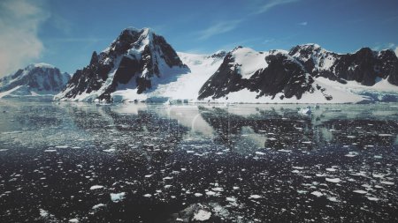
Antarctic Lemaire Channel Water Surface Drone ... 

Media-ID: B:703929454
Nutzungsrecht:
Kommerzielle und redaktionelle Nutzung
Antarctic Lemaire Channel Water Surface Drone View. Epic Wildlife Polar Peak Mountain Scenery Overview. Ocean Seascape Global Warming Arctic Island Concept Aerial Flight Footage Shot 4K UHD
| Vorschau |
Varianten
Mediainfos
|
Dieses Bild mit unserem Kundenkonto ab €0.95 herunterladen!
|
||||
| Standardlizenz: JPG | ||||
| Format | Bildgröße | Downloads | ||
|
Print XXL 15 MP |
3840x2160 Pixel 32.51x18.29 cm (300 dpi) |
1 | ||
| Standardlizenz: JPG | ||||
| Format | Bildgröße | Netto | Brutto | Preis |
|
Web S 0.5 MP |
500x281 Pixel 16.93x9.52 cm (75 dpi) |
€3.90 | €4.17 | |
|
Print M 2 MP |
1000x563 Pixel 8.47x4.77 cm (300 dpi) |
€6.90 | €7.38 | |
|
Print XL 8 MP |
2000x1125 Pixel 16.93x9.53 cm (300 dpi) |
€12.90 | €13.80 | |
|
Print XXL 15 MP |
3840x2160 Pixel 32.51x18.29 cm (300 dpi) |
€15.90 | €17.01 | |
| Merchandisinglizenz: JPG | ||||
| Format | Bildgröße | Netto | Brutto | Preis |
|
Print XXL 15 MP |
3840x2160 Pixel 32.51x18.29 cm (300 dpi) |
€79.90 | €85.49 | |
| Media-ID: | B:703929454 |
| Aufrufe: | 1 |
| Beschreibung: | Antarctic Lemaire Channel Water Surface Drone View. Epic Wildlife Polar Peak Mountain Scenery Overview. Ocean Seascape Global Warming Arctic Island Concept Aerial Flight Footage Shot 4K UHD |
Nutzungslizenz
| Nutzungsrecht: | Kommerzielle und redaktionelle Nutzung |
Userinfos
| Hinzugefügt von: | mozgova |
| Weitere Medien von mozgova |
Bewertung
| Bewertung: |
|
Suchbegriffe
| Keywords: |


